So you have some data that includes latitude and longitude, you add it to the map ... and it doesn't line up. You've got some spatial reference/projection problem. Figuring out what coordinate/projection system your data came from is not always straightforward, and often involves looking more deeply into the source of your data (for metadata). One rule of thumb: if your data shows up around the horn of Africa in the Atlantic Ocean, you're probably trying to display unprojected coordinates in a view (or with other data) that's in a projected system. Most of the time that you have unprojected coordinates the data will be in WGS 1984 or NAD 1983 (HARN or not). You can often figure out which one by trial and error.
In any case here are all steps for going between unprojected coordinates and a projected system. These are instructions for ArcMap, but similar would apply for QGIS.
We'll plot the coordinates, export the data, and project it.
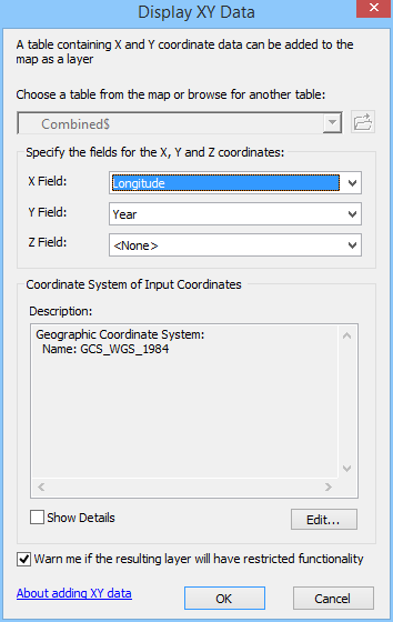
1. Add the tabular data (xls or csv usually) to ArcMap. Right click on the layer and choose "Display X Y data", choosing latitude, longitude and WGS
2. From the created plot layer, export to feature class (shapefile), and add this to the map
3. Project this shapefile into the projection of the GIS data

No comments:
Post a Comment